Many settlements started along a river. We need rivers for fresh water supply, food and transportation.
Rivers inspired many poets and painters in the past, and now photographers capture their beauty. In this post we present 50 of the longest and largest rivers of the world. A river is defined as "a large natural stream of water flowing in a channel to the sea, a lake, or another river."

Ok, let's get started!
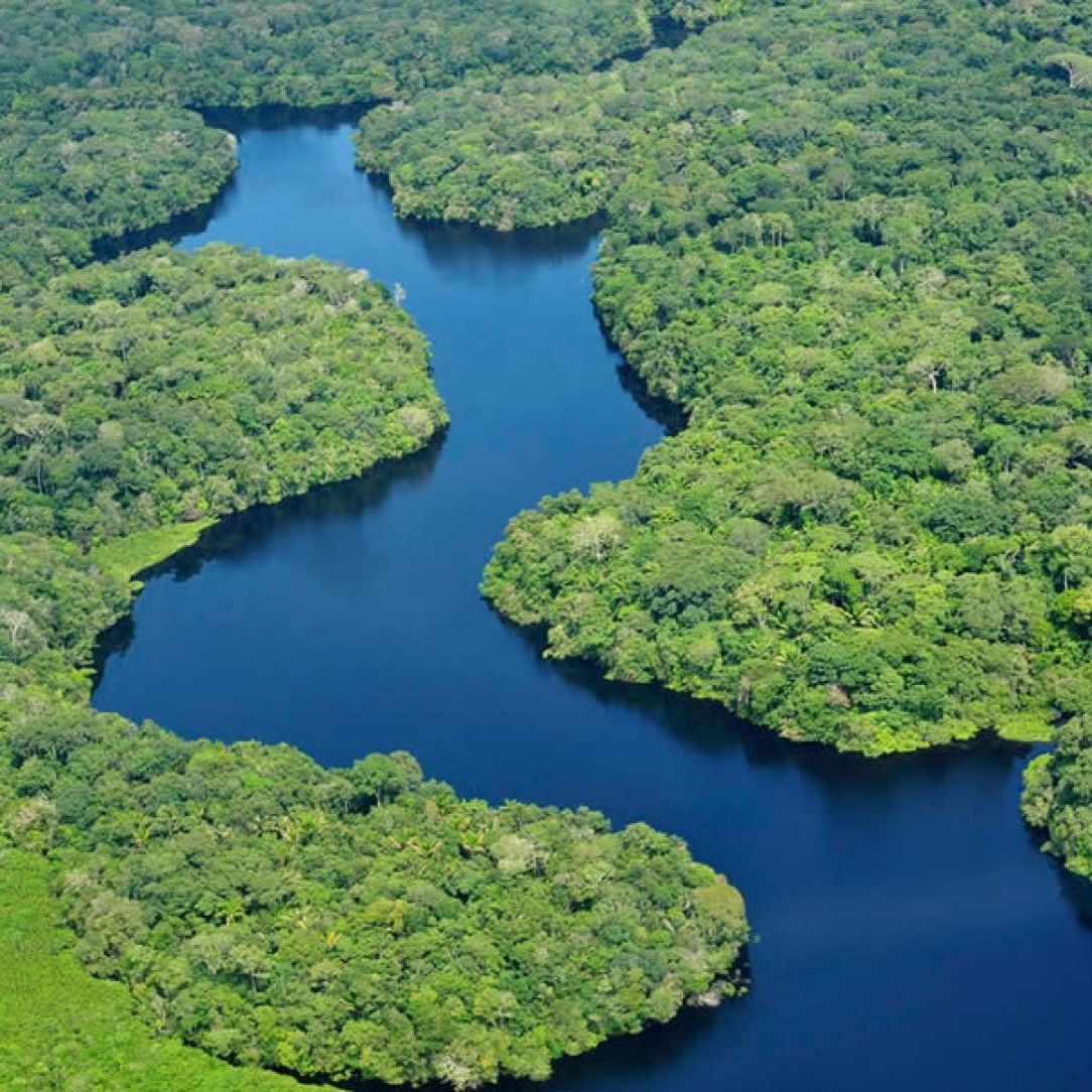
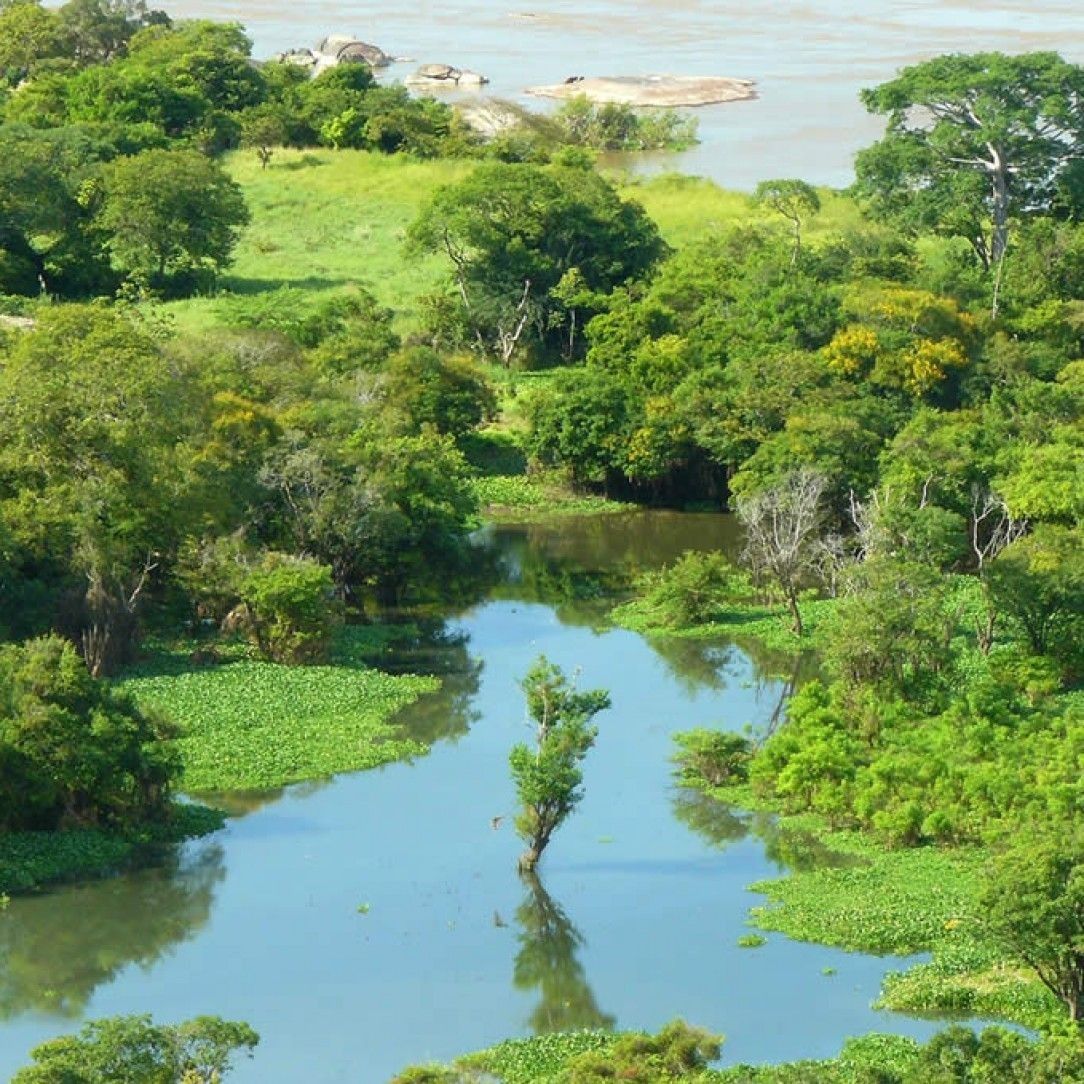
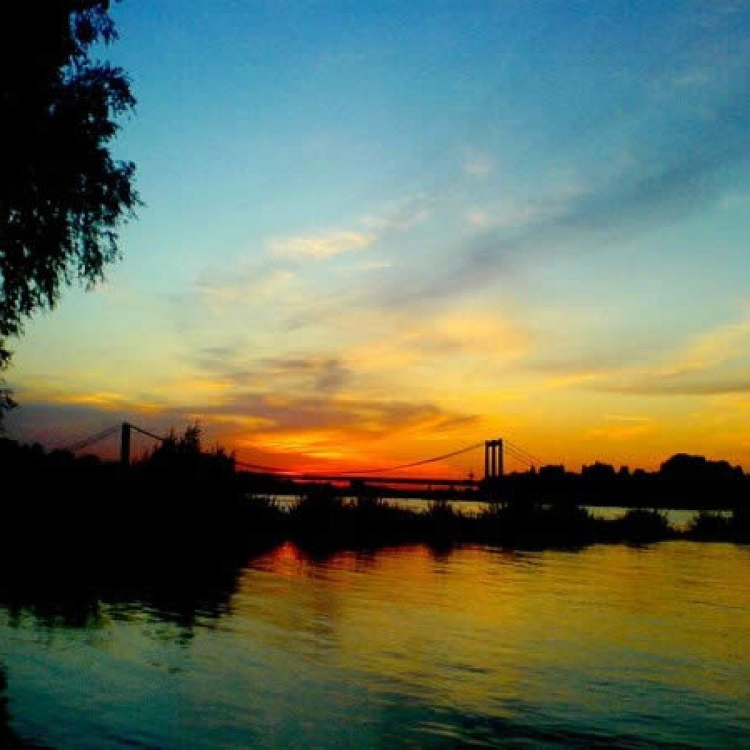
The Amazon in Brazil
Starting off the list brings one of the most famous rivers in the world, the Amazon River. This river touts being the largest river in South America and counts as the second largest river in the world by most definitions.
Some may argue that it is the largest, but it depends on where you want to count the origin point, one source looks at the mountains of Chile. Regardless of size by length, it does overtake the competition in discharge by volume coming in at over 200,000 cubic meters per second.
The headwaters of the amazing Amazon feed from the Apurimac River and the Mantaro River in Peru. Tributaries from around South America come together to create the amazing water system of South America. An interesting fact about the Amazon comes from the fact that no bridge spans the entire width of the river. This reflects the lack of roadways in the region, but you can still get where you are going by Ferry.
Quick facts about the Amazon river:
How long is the Amazon river?
6400+ KM or 4000+ miles.
Where is the amazon river located?
The Amazon river flows through South America.
Where does the Amazon river begin?
The Andes in Peru,
How wide is the Amazon river?
The Amazon width varies between 1km (0.6 miles) and 100km (62 miles).
How deep is the Amazon river?
The depth varies between 20m and 100m.
Where does the amazon river end?
It ends in the Atlantic Ocean in Brazil.
What makes the Amazon river distinctive?
It is the longest, but also drops more water in the Atlantic ocean than any other river.
What countries does the Amazon River flow through?
Due to its length, it flows through lots of countries: Peru, Ecuador, Colombia, Venezuela, Bolivia and Brazil.
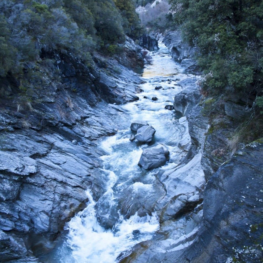
Muru river in Norway
While not boasting any records, the Muru clocks in at just over 10km long. It serves as the primary source of water for Lake Gjende near Jotunheimen in Southern Norway. The source of the river comes from a glacier known as Austre Memurubrean.
One of the more unique aspects of the river comes from the green color it sports flowing down the mountain. This hue comes from the glacier runoff that contains clay.
A river does not require a record to be beautiful. The Muru creates a picturesque view of the mountains and river, especially for those who enjoy kayaking. The river boasts a popular spot for hikers travelling across the Besseggen, photographers, and water enthusiasts.
Be prepared though, if you are a kayaker, the best parts to kayak do not have road access. If you are looking for beauty in nature, put this river on your bucket list.
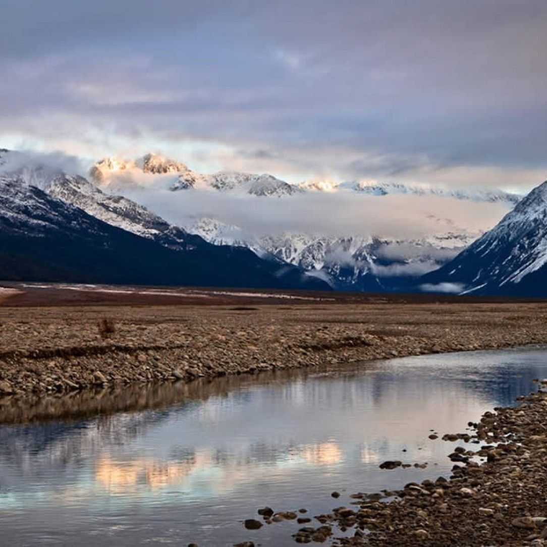
Wheaton River in Canada
Of course, if you are looking for beauty, the Wheaton River offers one of the most breathtaking scenes in Canada. Located in the Yukon, the remote river boasts many photo ops from gorgeous icy shots of the forest, winding valleys, and a multitude of wildlife.
The river starts at Dail Peek and travels into the fourth largest drainage basin in the world until finally reaching the Bering Sea at over 200,000 cubic feet per second.
The Wheaton river offers a lot of activity for such a little river. The picturesque location boasts a thriving community and a slice of paradise at the Wilderness Retreat along the river banks.
The waters are still enough in the area to canoe and kayak at leisure and even see the Northern Lights from time to time. If you are looking for a bit more adventure, another section of the river reports as the 8th best spot in the world to pan for gold.
The Seine in Paris
The Seine river creates a crucial commercial waterway that serves most of northern France. From its sources, the longest reaches of this river clock in at 777 km passing through Paris and emptying into the English Channel at Le Havre.
Many ocean going vessels can travel up river via the dredged waterways, as far as Roeun, which sits 120 km from the sea. The river basin itself feeds all northern France and parts of Belgium.
While an impressive length, the biggest attraction the Seine offers comes from the boat tours through Paris. Along these trips you can sightsee the most famous monuments of the city of love, from the Louvre, the Eiffel Tower, the Musee d’Orsay, and even Notre Dame.
The city itself has 37 separate bridges that create a network of roadways across the river. The river has seen some of the most historical events in France’s history from invasions to the 1900 summer Olympics.
Quick facts about the Seine river:
Where is the Seine river located?
In France.
How to pronounce 'Seine'?
Listen to this:
How long is the river Seine?
776 km or 485 miles.
How deep is the Seine River?
On average, its between 9 and 10 meters deep.
What city in europe evolved around an island in the seine river?
Paris.

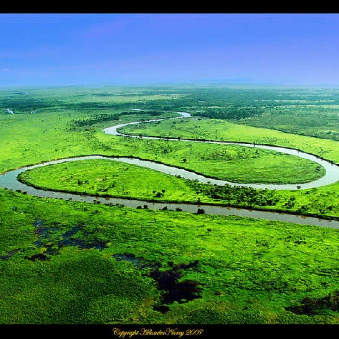
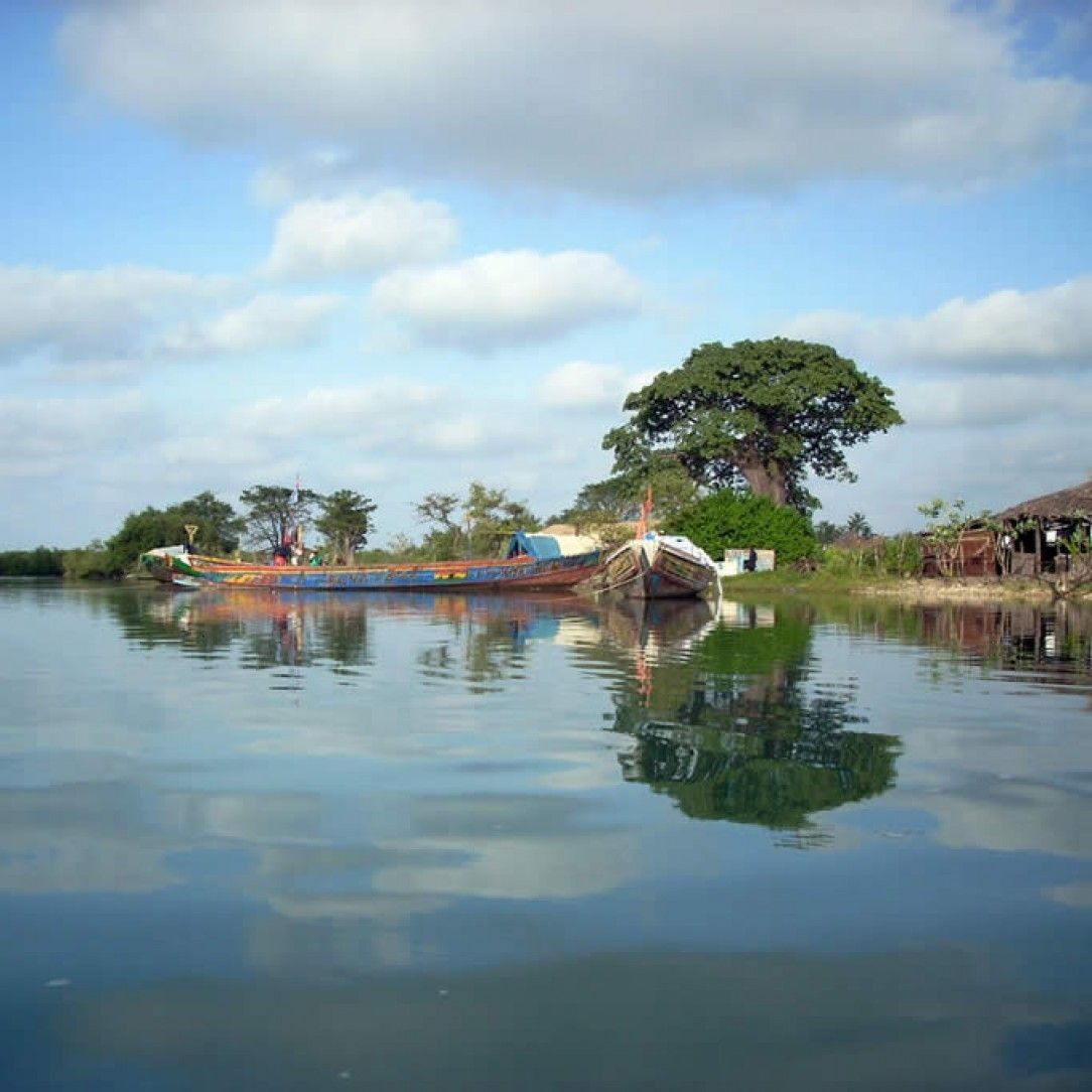
The River Niger in Mali
Clocking in as the third longest river in Africa after the Nile and the Congo, the Niger river winds its way through western Africa. The river originates along the Guinea Highlands less than 250 km from the Atlantic Ocean.
However, it flows north to northwest in a giant crescent shape that finally ends over 4,180 km away in the Niger Delta. It also boasts some of the clearest waters in the world for much of its length, carrying a tenth the sediment of the Nile.
The unusual route the river takes makes it the source of water for the Sahara desert in the region and the city of Timbuktu. One of the most unique qualities of the Niger river happens just before the delta where it loses two-thirds of its potential flow.
Instead of simply emptying into the ocean, the gradient decreases suddenly to create a series of braided streams, lakes and marshes. The feature gives a huge boon to the fishing and agriculture for the area.
Quick facts about the Niger river:
Where is the Niger river?
Its origin is in Guinea.
How long is the Niger river
4180 km or 2600 miles
What countries does the river Niger flow through?
Throught Guinea, Mali, Niger, Benin, Nigeratia and ends in the Niger Delta in the Atlantic ocean.
Why is the Niger river important?
Its an important source of water in the Northern parts of the Sahara desert.
The Loire in France
The river Loire boasts the largest river in France, but pales in comparison to many others around the world as far as length goes. What it lacks in length is made up in heritage and touted as one of the most important rivers in human history.
History tracks this river as the cradle of civilization for the region, serving tribes and civilization since the Neolithic period. During the iron age, the river worked as a trade route for the Mediterranean, Greeks and Romans.
In the modern age, the River Loire is known as the Garden of France due to the clusters of Chateaux and vineyards that dot the landscape. Originally, these structures served as strategic feudal strongholds and defensive fortifications, they now are privately owned homes that showcase the depth of history from the medieval and renaissance periods.
Over a thousand different chateaux help create one of the most vibrant tourist areas in France.
Quick facts about the Loire river:
Where is the Loire river?
In France.
How to pronounce Loire river?
Listen to this:
Where does the Loire river end?
In the Atlantic ocean.

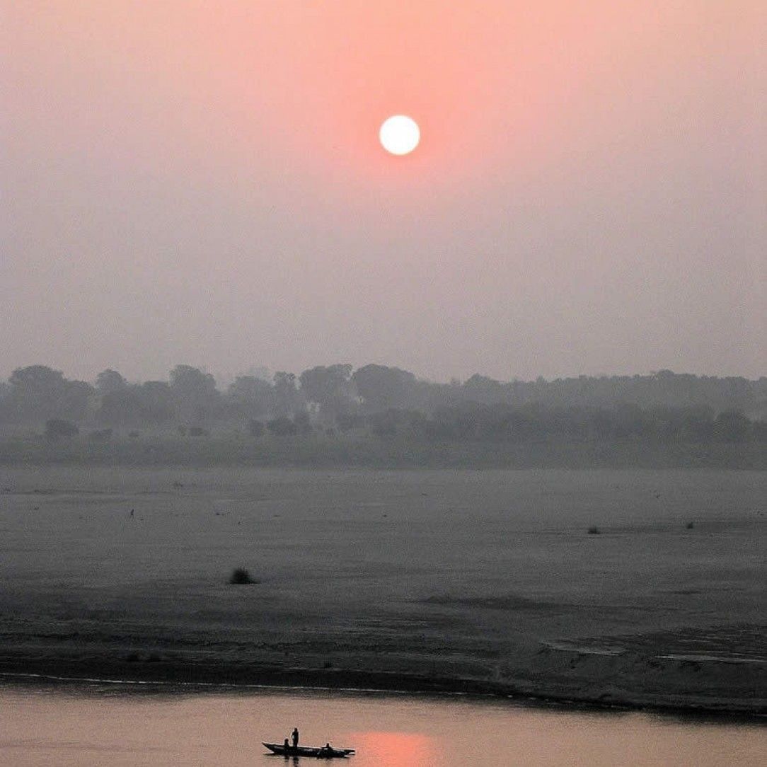
Ganges in India
Out of all the rivers on this list, the Ganges may hold the record for supporting human life. Millions of people across India and Bangladesh live by the river Ganga that serves as a trans-boundary to Asia.
It is revered as life bringer and even worshiped as the goddess Gnaga in Hinduism. The drainage basin for this river feeds most of northern India and surrounding countries.
Unfortunately, the river Ganges holds another record as being one of the most polluted rivers in the world. Severe pollution threatens not only the millions of people depending on the river, but the fish, amphibians that call the river home and the animals that live from the water.
The amount of pollution near Varanasi counts over 100x the legal limit set forth by the official government and clean up plans have all but failed.
Quick Facts about the Ganges river:
Where is the Ganges river and where does it begin?
In India (Northern)
Why is the Ganges river important?
The river provides drinking water, water for crops and is an important symbol in the Hindu religion.
Why is the Ganges river so polluted?
Overpopulation, poor sewer system and industrial waste all contribute to the pollution of the Ganges.
Why is the Ganges river sacred
Because it is the personification fot ehr Goddess Ganga.
The River Thames in London, UK, Europe
The River Thames may offer some of the most visually stunning sights on this list. Originating near Kemble in the UK, this river flows through Oxford, Reading and all greater London area. In fact, many may recognize the river Thames from London’s most notorious sightseeing, including Big Ben and the Ferris Wheel.
You may also find different names for the river depending on location. Oxford refers to it as Isis, and it is known as the Tideway in the lower reaches.
This is another river that boosted human civilization. This maritime route has served for shipping supplies, navigation, watermills, and even international trade. The river Thames has also served three separate Summer Olympic Games, one in 1908, another in 1948, and the most recent in 2012 for London Olympics.
Between the many bridges, locks and weirs, the River Thames serves as one of the most human influenced rivers in the world as well.
Quick Facts about the Thames river
Where is the Thames river?
Great Britain
How to pronounce 'Thames'?
Listen to this:
How deep is the Thames?
An average of 20 meters depth.
How long is the Thames?
346 km or 214 miles.

Congo River (Formerly known as Zaire river)
The Congo comes in second place on many scales for rivers. For starters, it is second to the Amazon for discharge by volume. It boasts the second largest river in Africa, coming behind the Nile. What it is known for though, is being the deepest river in the world, measuring depths of over 220 meters. It also holds the title of the only river to cross the equator twice.
The Congo flows over 4,700 km to basin over 4 million square km of Africa, which is almost 13% of the continent. Just like the Amazon, the Congo serves a huge portion of the rainforests with fresh water. It provides economic keystone for many areas of Africa that do not have roads or railways, helping with transportation and agriculture.
Since it is one of the most powerful rivers in the world, it could potentially service all of Africa with hydroelectricity, of which forty hydropower plants already exist along the length of the river.
Quick Facts about the Congo river:
Where is the congo river?
It's located in West-Central Africa.
How long is the Congo river?
4700 km or 2900 miles.
Where does the Congo river begin and end?
How wide is the Congo river?
The Congo river has widths from 5.5 km all the way up to 13 km.
How deep is the Congo river?
Depths of up to 220 meters are measured, making it the deepest river in the world.
What countries does the Congo river flow through?
In order: The Republic of Congo, The Democratic Republic of the Congo, the Central African Republic, Western Zamgia, Northern Angola, Cameroon and Tanzania.
The Yarra River in Melbourne Australia
The Yarra river, or Yarra Yarra river, as it used to be known as served Melbourne and the greater Melbourne area before it empties into the Hobson’s bay at Port Phillip. The name of the river comes from the aboriginal name meaning ever flowing and helped early civilization in Australia to flourish.
The European settlers found the river and took over, establishing their colony at Melbourne. Since then, the Yarra river progressively changes to the needs of the city.
Unfortunately, extensive changes to the agriculture in the area altered the original course of the river. During the gold rush, many mines and tunnels also changed the river as needs for transports came up.
In the modern day, logging in the northern changes the northern portions of the river, destroying many Marshlands that feed the Yarra River. Overall, the river served a purpose to help sustain life, but has been heavily modified from the original course.

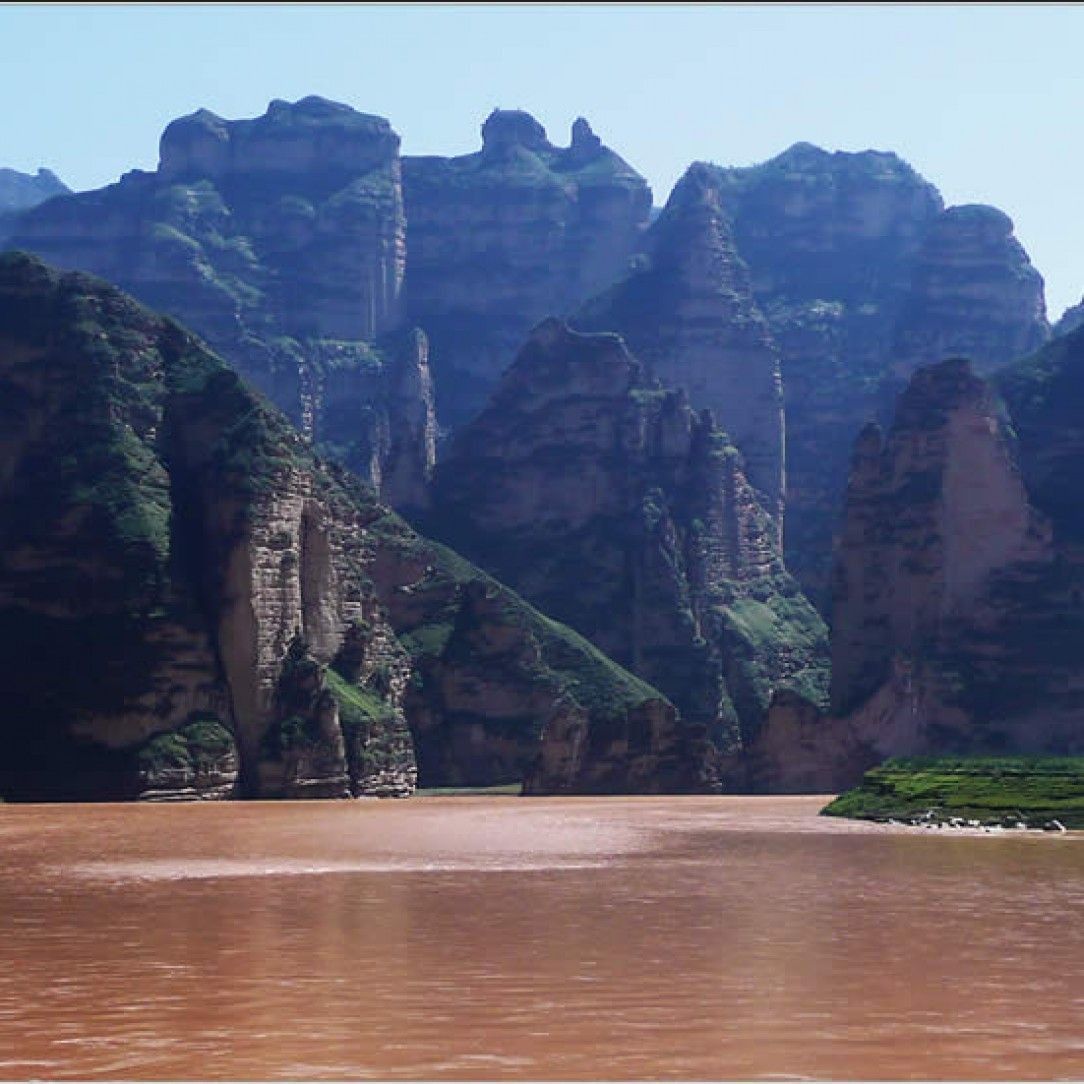
Yellow River in China
Huang He flows as the second longest river in China and is known as the Yellow river due to the distinct color of the water as it flows. It is the sixth largest river system in the world flowing over 5,400 km from the Bayan Har Mountains through nine provinces and emptying in the Bohai Sea near Dongying. The basin area drains almost 800,000 square km across one of the most prosperous regions in China.
In fact, the river is regarded as the cradle of China’s prosperity and the birthplace of the civilization. However, it also harbors a darker history as one of the deadliest rivers in the world due to flooding.
Due to the unique silt composition, subaqueous dams slowly build up from the fine silt run off. Eventually these create floods that wreak havoc across the region. The worst in recorded history occurred in 1931 which reported to kill 1 to 4 million people.
Quick Facts about the Yellow river:
Where is the Yellow river?
China
Why is the Yellow river yellow?
From flowing over the sediment of the Loess Plateau in China.
Why did the Yellow river flood so frequently?
Because of rainfall and the large amounts of sediments and silt that get pumped into the river.
Zambezi river in Africa
The Zambezi river clock in as the fourth longest river. This river basin serves most of the eastern side of the continent where the Nile and Congo do not reach. Starting in Zambia, it flows through eastern Angola and several other countries before emptying into the Indian Ocean. Many people may recognize its unique waterfalls, Victoria falls and Chavuma Falls more than they may know the name of Zambezi.
This river gives life to the regions and helps sustain multiple agricultures across the eastern and southern reaches of Africa. It also provides hydroelectricity from the Kariba Dam which powers Zambia and Zimbabwe.
The Cahora Bassa Dam in Mozambique provides power to the country and South Africa. While this river may not come across as majestic as the other rivers in Africa, it remains a notable fixture and important river to many people.

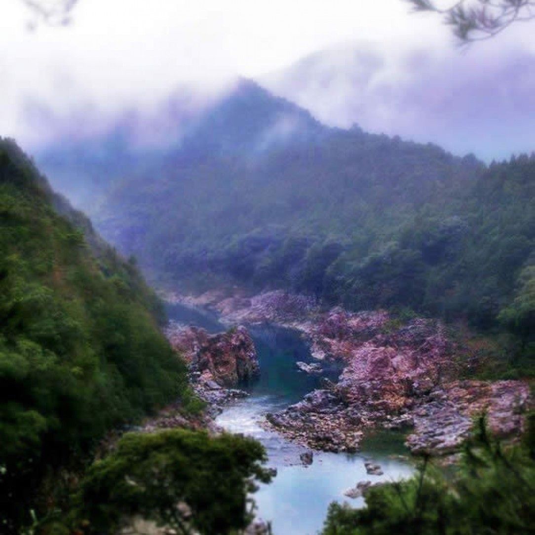
Cahabòn River in Guatemala
Many rivers so far on this list boast life across the globe. While the Cahabon does not carry any prestigious titles and only runs a meager 200 km compared to some on this list, it may be one of the most beautiful rivers on the list. It sources in Sierra de las Minas mountain range and flows north through many small cities and joins up with the Polochic River. The biggest claim to fame this river offers comes from the tourist aspect.
If you are a fan of kayaking or white-water rafting, the Cahabon offers some world class rapids. These are not your average rapids though. This river chops up in many sections of class 3 and 4 rapids offering one of the most challenging courses in the world. Many different courses exist along the river, some of which are family friendly. If you are looking for some serene nature while adventuring, Guatemala may be hiding a few gems you did not consider.

Mosman River in Australia
The Mossman River offers another exemplary photo ops place to visit. If you are ever in Australia, the Mossman flows through deep valleys across the Mount Lewis Forest Reserve, the Mossman Gorge, the Daintree National Park and supports the township of Mossman before emptying into Trinity Bay and the Coral Sea.
This river drops an astonishing 1,050 meters in a short 24 km path, making it one of the largest elevation change rivers in the world.
One of the biggest boons to the river comes from the tourist attraction. The river in the dry season boosts clear waters with snorkeling for any ages to meet more than the 30 different species of fish, lizards, and birds. You may even spy an elusive platypus.
During November to April, the “green” season offers stronger currents and boasts a challenge for swimmers. The river takes on a green hue in certain sections, hence the name of the season.

The Danube in Europe
The Danube flows through ten different countries in Eastern and Central Europe, creating the second longest river in Europe. Originating in Germany, it either passes through or borders Austria, Slovakia, Hungary, Croatia, Serbia, Romania, Bulgaria, Maldova and the Ukraine in that order.
It finishes its long journey in the Black sea. The basin and tributaries for this river expand into a further nine more countries. It provides an important backbone to many trade routes, drinking water, and hydroelectricity.
The Danube once served as the final frontier to the Roman Empire, blocking the northern tribes on many fronts. After the fall of the Roman Empire it became a central trading route through most of Europe and connected the world through its 2,415 km route.
Today, that entire length is navigable through large boats. The Danube gives another example on the list of a civilization cradle, boasting life for human history in several ways.
Quick Facts about the Danube river:
Where is the Danube river?
It originates in Germany and continues in Austria, Slovakia, Hungary, Croatia, Serbia, Romania, Bulgaria, Moldova and Ukraine.
How long is the Danube river?
2850 km or 1770 miles.

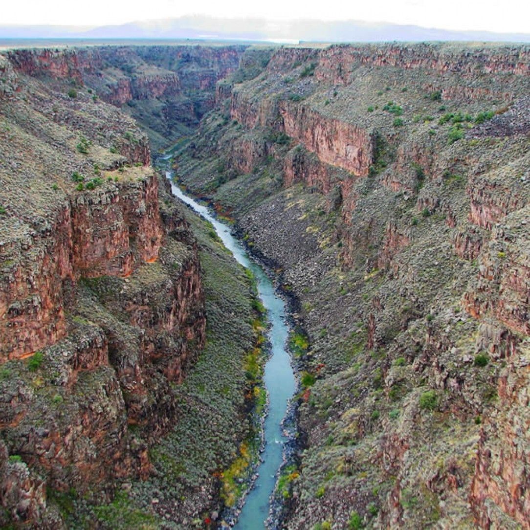
Rio Grande in the USA
The Rio Grande shows one of the most iconic rivers in the world due to the landscape, not necessarily the river. Starting in Colorado in the United States, it flows through New Mexico and forms as a natural border between the United States and Mexico before emptying into the Gulf of Mexico.
While it measures a total of 1,896 miles, the course of the river shifts which can change it to be the fourth or fifth largest river system in North America depending on the time of year.
Unfortunately, the Rio Grande maintains as one of the largest water sources for Texas and northern Mexico with its river basin that covers over 182,000 square miles. Coupling this fact with agricultural demand, heavy water consumption, and irrigation, the river only empties into the Gulf of Mexico with 20% of its natural flow.
Without the Rio Grande, the region would not be able to support the vast amount of people that it does.
Rio Orinoco in Venezuela
Venezuela is the home to the Rio Orinoco which provides water to the northern reaches of South America. This river basin covers 880,000 square kilometers mostly in Venezuela and Colombia.
It touts being one of the longest rivers in South America and the third largest discharge by volume in the world. Just like its southern neighbor the Amazon, the Rio Orinoco provides life to thousands of species of flora and fauna among the northern reaches of the rainforest.
Different from the Amazon though, this river can be broken apart into four distinct regions. These regions include the upper, middle, lower and delta. The upper and middle service large sections of forest with rapids and the Guiana Shield that quickly flows down to a large flood plane and then out to the Delta.
The river serves as a trade route and economic necessity to many cities in the region. Most of the river has been dredged for larger ships to be able to navigate through.
Brisbane River in Australia
Another important river in Australia may not hold any records, but it does serve an important purpose. Named after the first governor of New South Wales, Sir Thomas Brisbane, the river flows from Mount Stanley approximately 344 km into the Moreton Bay and the Coral Sea.
Later, the Moreton Bay adopted the same name as the river becoming known as Brisbane and one of the larger cities in Australia. The city flourishes at the mouth of the river, despite it being a tidal estuary.
To help alleviate the problem of brackish water, the Wivenhoe Dam was built to create Lake Wivenhoe and a long term potable water source for the city. The river hosts a source of natural beauty for the region, abundant fish and rife with vegetation.
While it may not win any awards, the river has been an important stepping stone for the city development and shows another entry on the list of how people have used rivers for progress over time.

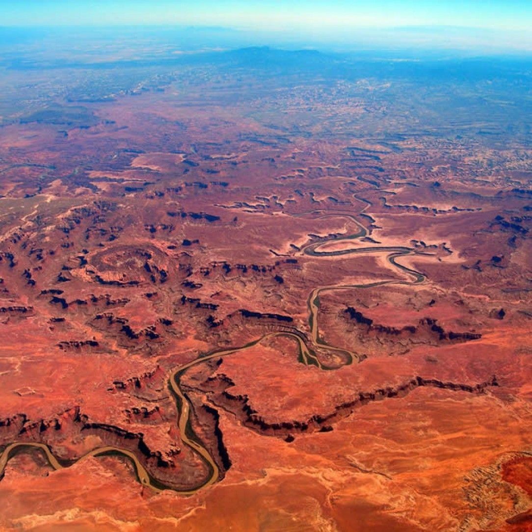
Colorado River in the USA
One of the most iconic rivers in the United States is the Colorado river. Clocking in at 1,450 miles long, this river flows through seven different states in the United States and two in Mexico. Like the Rio Grande, after originating in Colorado, this river flows south and eventually forms part of the U.S and Mexico border before flowing out into the Gulf of California between Baja California and Sonora.
Just like its eastern counterpart the Rio Grande, the Colorado river creates a mainstay for potable water for over 40 million people. In fact, most of the river is controlled via dams, reservoirs and aqueducts that mostly divert water for irrigation and domestic water supply. The problem generated by over taxation on the river system caused the flow to stop. The river dries up approximately 100 miles north of the exit into the Gulf of California, which has not made it that far since the 1960’s.
Views along the River Nile
No list of rivers could be complete without the Nile River. This river contests for the longest flowing river in the world originating from two primary tributaries called the Blue Nile and the White Nile. The most distant source of the Nile can be traced to Rwanda or Burundi flowing north through Tanzania, Lake Victoria, Uganda and South Sudan. The Blue Nile joins it in Sudan and they flow northward through Egypt to empty into the Mediterranean Sea.
The drainage basin for the Nile covers 11 countries and runs northward 6,650 km. The Nile creates such a unique change in the landscape that it can be seen from space. The entirety of Egypt may be covered in sand, but along the banks of the Nile, vegetation and life exists, creating a swath of green through the land that can be seen in stark contrast from space.

On The Amazon
The Amazon reports to be anywhere between 6,200 km to 7,000 km. Most documentation counts it as at least 6,400 km. This important distinction marks the greatest controversy on rivers out there.
The Nile, the Amazon’s competition, runs anywhere from 5,500 and 7,000 km, but counts at least 6,650 km. Hey, what is 100 miles between friends? The biggest portion of the controversy comes from the measurement itself.
In 2001, the Nevado Mismi in Peru took over as the reported source of the Amazon. This new river makes the length of the Amazon at precisely 6,992 km or 4,345 miles. When looking at the Nile with the same instruments and methods of calculation, it measures at 6,853 km or 4,258 miles long.
The biggest factors to the measurements come from the time of year, the scale of measurements and the techniques. Which would you count as the longest?
Volga in Russia
The Volga runs the longest river in Europe, flowing over 3,521 km with a basin of over 1.3 million square km. It also touts the largest in Europe through discharge and basin.
The Volga starts in central Russia and flows south to southwest and eventually empties into the Caspian Sea. Eleven of the twenty largest cities in Russia call this basin home, and is generally considered to be the national river.
The Volga shows another cradle of life type river along the list. Many Eurasian civilizations have risen and fallen on the Volga steppes, from the Huns to modern day Russia. Today, it helps provide irrigation, potable water and hydroelectricity to many areas in Russia. That is of course during the nine months of the year it flows. For the hard winter months, most of the river freezes.

Rhone in France
The Rhone rises from the Rhone Glacier in the Swiss Alps, passes through Lake Geneva and then runs through southeastern France to empty into the Mediterranean Sea. This river has twice the annual discharge of its northern counterpart the Loire.
It offers a unique mouth that instead of a defined delta, it divides into two before hitting the sea. These parts are known as the Le Grand Rhone and Le Petit Rhone, and form the Camargue region of France.
This river creates one of the most important waterways through Europe, being a central trading route from the Mediterranean up to central France. This meant the Greeks could push their culture on the Gauls and expand northward with ease.
It also housed the first steam boat ever built. In modern times, the Rhone connects many major cities in France, from Arles to Avignon all the way to Lyon.
The Rhine in Germany
Another major river in Europe that rises from the Swiss Alps is the Rhine River. This one however, flows northward through most of Germany and the Netherlands before emptying into the North Sea.
It creates the second largest river in central and Western Europe after the Danube, running at 1,230 km overall. It also shares an interesting fact with the Danube that it formed the second portion of the northern frontier of the Roman Empire.
The Rhine connects many major cities throughout Germany. The largest of which is Cologne, but also Dusseldorf, Rotterdam, Strasbourg, and Basel. Many forts, strongholds, and castles have been built over the last two millennia on the river Rhine, making it a national symbol of Germany and a vital waterway for trade, commerce, and sightseeing. It connects many beautiful lakes and cities throughout northern Europe.
Zambezi in Zambia
The Zambezi like many other major rivers on this list can be divided into major sectionals. The upper portion of the Zambezi flows through Angola and massive grasslands before turning southward into a floodplain.
Victoria Falls forms the boundary between the upper and middle portion of the river. From the falls to Lake Kariba, the Zambezi offers some of the most breathtaking and challenging white-water trips in the world.
After the Cahora Bassa Dam, the Zambezi opens to the lower region and the delta. During the dry season, the river divides into hundreds of shallow branches with low banks where wildlife drinks and flourishes.
During the wet season, they come back into one united roaring river in a perpetual cycle. This section of the river gives life to many species in Africa such as lions, hippos, nile crocodiles, and hundreds more.
The River Nile in Egypt
The delta of the River Nile provides life to Egypt. In many views, the rise of the Egyptian empire and Sudanese kingdoms would not have been possible without the life giving waters of the Nile.
This fact pervades every facet of Egyptian life from the earliest ancient times, housing the most recognizable historical sites a stone throw from the river. Most of the populations of these countries exists along the banks of the Nile.
The Nile helped Egypt in more than just sustaining life though. The surrounding lands of the Nile flourished with agricultural life due to the silt. This allowed many crops like wheat, flax, and papyrus to thrive in an otherwise arid environment.
This civilization rose to power through trading these goods to other countries. The river itself in ancient Egypt was revered as the causeway between life and death due to its importance.

The Mississippi River in the USA
Clocking in as the second longest and second largest river basin in North America, the Mississippi river brings the next entry on the list. The massive Mississippi watershed touches 32 of the 50 United States and two Canadian provinces between the Rocky and Appalachian mountain ranges. On the world scale, the Mississippi river flows the fourth longest behind the Amazon, Nile, and Congo.
Aside from being enormous, the Mississippi River serves as one of the most important rivers in American history. Not only did native Americans live for thousands of years on the rivers and tributaries, it built a foundation for trade systems up and down the river from New Orleans all the way to St. Louis. The control of the river played a major part in the victory of the American Civil War.

Colorado River in the USA
The River itself starts in central Colorado in the heart of the Rocky Mountains. As it flows southwest, it passes through the famous Grand Canyon which was carved by the river over millennia of the river flowing. While it is controlled, many regions of the river offer beautiful scenery and breathtaking views.
The Colorado river passes through an amazing 11 different national parks and houses multiple white-water rapid locations.
These beautiful creations of nature also share triumph with human engineering. Some of the largest engineering feats work on the Colorado River, including the Hoover Dam.
While the dam was completed in 1935, many other dams and aqueducts were completed. However, once people realized the damage it caused to the local landscape, construction has all but stopped along the river.
Yangtze River in China
The Yangtze forms the longest river in Asia and holds a title of the longest river in the world flowing in a single country. Starting from Jari Hill in the Tanggula Mountains, it flows over 6,300 km eastward into the East China Sea.
The drainage basin of this massive river covers almost 20% of China and supports nearly one third of the country’s population. It houses many endemic species of animals as well.
Unfortunately, like a few other rivers on this list, the Yangtze suffers from industrial pollution. The river itself creates the cradle of life for much of China, contributing as much as 20% of the GDP for the country.
It also houses the largest hydro electric station in the world at the Three Gorges Dam. Fortunately, the government understands the importance of the river and has made moves to protect areas of it.
Dawn at the Amazon
While controversy still sparks about the length of world’s longest river, the Amazon boasts a couple of records that other rivers simply cannot match. First of all, this River is only a few hundred miles from spanning the entire width of South America from the Pacific Ocean to the Atlantic. The second record comes from volume as stated before.
Lastly, the Amazon Basin marks the world’s largest basin covering over 40% of South America.
The Amazon and its tributaries gather water from 5 degrees north latitude all the way to 20 degrees south. In the average dry season, it covers over 110,000 square kilometers or 42,000 square miles.
In the wet season, this number skyrockets, covering up to 350,000 square km or 140,000 square miles and rising over 9 meters. The Amazon is responsible for up to 20% of all fresh water entering the ocean supply.

The Mekong River in Vietnam
The Mekong River creates the trans boundary between many countries in Southeast Asia making it the seventh longest in Asia. This 4,350 km river borders China, Myanmar, Laos, Thailand, Cambodia, and Vietnam before emptying into the South China Sea. Not only does it provide a natural border, it supports many of these countries with agricultural, irrigation, potable water and trade routes.
While it is used for navigation, the seasonal changes across its length can create heavy rapids, waterfalls, and be challenging to transverse. However, in other areas, such in Vietnam, most of the river is used for agriculture and growing wet rice. It also provides fisheries and transport needs to many citizens in the area. The delta in Vietnam offers one of the natural phenomena in the world where the river flow inverts with the tides causing flooding along the flat delta.
The Danube in Germany
Speaking of trans boundary rivers, the Danube needs a second mention. Not only does this river pass through 11 different countries, it directly connects 4 capital cities in Europe. From its origin in Germany, it passes through twenty different cities before hitting Austria.
In Austria it goes through Vienna, in Slovakia, it hits Bratislava, then in Hungary it passes through Budapest, and finally in Serbia it hits Belgrade. No other river in the world hits as many capitals.
With so many different locations along its 2,850 km journey, the river offers some of the best sightseeing in the world. Of course, you could travel the entire length and see some of the best historical sights in western and northern Europe.
Just be prepared for a long trip though, if you were to stop in each city along the way for just one day, your trip would at minimum be 100 days long. Just think of all the wonderful photo ops you would have from this one river though.
Daintree River in Australia
Another spectacular river for photo ops comes in the Daintree river in northern Australia. This river in Queensland meanders 100 km through some of the richest and most diverse bio life in Australia’s Daintree Rainforest.
It congregates over 2,107 square km along its course supporting the rainforest life before opening into dense mangrove swamps. Of its basin, the last 33 square km create an estuarine wetland of highly salinized water.
The water of this river descends over 1,270 meters from the highest point until it reaches the Coral Sea just north of Wonga Beach.
The river silt and mangroves have created a large sandbar that protects the river. If you are looking for a diverse river adventure, the Daintree offers a huge diverse change in climates and areas to transverse, from scenic views to amazing wildlife.
Ural in Russia
The Ural river flows as the third longest river in Europe, originating in the Ural mountains and emptying into the Caspian Sea. At 2,428 km this river not only forms most of the border between Russia and Kazakhstan, it also forms the conventional boundary between Europe and Asia.
After flowing south down the Ural mountain range, it turns east and meanders across a broad plain, giving some of the most beautiful pictures from the mountain range.
While being one of the largest rivers in Europe, 65% of its annual discharge occurs during March and April where spring floods rush with melting snow. This flow all but stops around October where the freezing temperatures drop the river to around 5% of its annual flow.
This disparity in the flow creates a rhythmic cycle for migration for the wildlife in the area, including hundreds of species of birds.

Po in Italy
Not only does the Po river provide beautiful pictures of the Italian countryside, it provides a mainstay water source to the flood plain in northern Italy. Starting from the Cottian Alps, this luxurious river begins on the hills of Pian del Re and travels 652 km to the Adriatic Sea, exiting near Venice. Once it hits the flood plain, the slope decreases to 0.35% gradient to create a meandering river experience.
With over 74,000 square km of watershed, the basin is heavily controlled through many important Italian cities including Turin and Ferrara. It also connects with the Milan through a network of channels that Leonardo Da Vinci helped design. The majority of the watershed supplies the agriculture basis of northern Italy which produces a huge amount of grain for cereals and rice.

Red River in Vietnam
The Hong River, known as the Yuan River or Red River, flows from its reaches in the Yunnan province southwest through China then Vietnam and emptying into the Gulf of Tonkin. Historically, this river formed the backbone of trade through southeastern Asia until the completion of the Kunmin-Haiphong Railway in 1910. Today though it is still used for transportation, although not much for heavy trade routes.
The primary reason for this comes from the sheer number of cities and provinces this river travels through. In the modern days, most of the waterways are used for agriculture and cultivating vast amounts of rice. From the picture, you may have determined the reason it is known as the Red River. The heavy brownish red silt gives it the hue, which in turn creates such a rich soil and farmlands for the cities it passes through.
Kumano River in Wakayama-ken in Japan
The Kumano River along the Kii Peninsula in central Japan flows through Nara, Wakayama and Mie prefectures. While it may run only 183 km in length, it offers one of the most beautiful rivers in the world.
The large mountains and valleys that surround the water way create some of the best photo ops of any river in the world. In fact, t he river is regarded as a sacred site along the pilgrimage routes in the Kii Mountain Range and is protected as an UNESCO world heritage site.
Starting in the Yoshino-Kumano National park, the river rises from Mount Omine and travels in southward through Japan to drain into the Pacific Ocean between Shingu, Wakayama and Kiho, Mie.
Along this short distance, numerous Buddhist and Shinto temples dot the landscape giving this river a particularly spiritual presence. You do not need to be religious to enjoy the beauty in this region, but it offers an amazing journey.
Steenbras River Mouth in South Africa
The Steenbras River in South Africa flows through the country to provide agriculture and hydroelectricity for most of South Africa. Two large dams, an upper and lower dam, create an efficient system to produce electricity.
The lower dam is a gravity concrete arch type located above Gordon’s bay near Cape Town in South Africa. It is one of many rivers that provide potable water to Cape Town.
The mouth of the river that empties into the Pacific offers some picturesque moments of the turbulent waters. Several wonderful hiking trails through the mountains create adventures for those seeking to connect to nature. Some of the notable selections along the river include the Crystal Pools from Gordon’s Bay and the Steenbras River Gorge. The mouth itself can be accessed from the Cape Whale route.
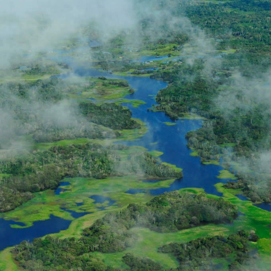
The Amazon River
Not only does the Amazon river boast impressive records, it creates life and biodiversity for thousands of different species of animals and plants. In fact, over 5,600 different species of fish can be found along the amazing length of river, many of which cannot be found anywhere else in the world. More aquatic species include over 100 different species of electrical fish, including the electric eel, river stingrays and even crabs.
Not impressed yet? The Amazon river and basin boasts a home to more than a third of all known species in the world. This river feeds a forest that covers over 5.4 million square kilometers.
The river covers such a vast territory that scientists still discover multiple new species every single year. Many mammals call the river home, including manatees, giant otters, and the river dolphin. This does not consider the birds, butterflies and other beautiful creatures that live around the Amazon.
Hitara River in Iceland
While many beautiful rivers run through Iceland, the Hitara may offer some of the most beautiful photogenic rivers in the country if not the world. Just a 90 minute drive from Reykjavik, the Hitara river is not only gorgeous, it is renowned as one of the best fishing spots in the world.
While only 29 km in length, the scenery is dominated by the Fagraskogarfjall mountains and creates a beautiful connection to nature. However beautiful, the biggest draw comes from the fishing community. If you are an angler, consider a trip to Iceland to check out this scenic spot.
Many lodges along the river cater specifically to fisherman who come from around the world to take a pick at the Atlantic salmon. Starting in Mid-June, the fishing season opens up to allow fishers to come and catch their fill.

The Mekong River in Thailand
Much of the Mekong River flows among the various countries in southeast Asia. Many regions of the river can be treacherous or difficult to navigate due to the chaotic flows and seasons. However, in Thailand, the lower basin of the Mekong shows picturesque views and gentle waters. Most of northeast Thailand and Loas lie within the lower Mekong Basin. The wet season runoff from the countries creates turbulent waters further downstream.
The difficult waters from this river have divided the people in the region more than uniting them. This comes mostly from navigation, not the people themselves. In Thailand though, the Mekong offers rich biodiversity in its lower basin.
This subregion boasts over 20,000 plant species, and thousands more fish, amphibians, birds and mammals. While this does not match something the size of the Amazon, it is still one of the most diversified river basins in the world.
Kartong River in Gambia
Kartong lies along the Allahein River in Gambia and offers some of the best tourism beaches and river experiences in the world. This tiny river flows through west Africa and empties into the Atlantic Ocean.
Most of the area shows picturesque beaches and bays along the mouth of the river. Many tours offer exploration of the river sights such as bird watching, the reptile farms, and crocodile pools. Kartong boasts another fine fishing spot on this list as well.
While this river may be tiny compared to many others on this list, it shows wonderful locations to connect with nature and a small tourist destination. If you enjoy exploring the wilds and fishing, the small town of Kartong can offer you a great excursion to go adventuring with.
Argentina in Italy
Nestled in the mountainous region between France and Italy, the Argentina flows pristinely towards the Ligurian Sea. Surrounded by majestic mountain views, the Argentina may be a blip on the map but shows some beautiful photo opportunities. If you ever stop in Triora Italy, check out this gorgeous river. The Argentina is aptly name as the word translates into silvery.
Puncak in Indonesia
This gorgeous picture snapped near Puncak comes from the Angke River that flows from the mountain near the picturesque Telaga Warna Lake. These serene waters create a popular tourist attraction for people from Jakarta and Bogor. While less than 100 km long, this river creates many photo ops along its path to the Java Sea.
Ottawa River in Canada
The Ottawa River flows through Ontario and Quebec and is named after the Algonquin word meaning “to trade”. The aptly named river created a major trade route from Eastern Canada to the western reaches at the time.
Most of the river defines the border between the two providences. It is the longest river in Quebec and joins up the to St. Lawrence River at Montreal. It is the largest tributary to the river and drains an area of 146,300 square kilometers.
Today the river helps with transportation and hydroelectricity from many dams along the river. Unfortunately, the construction of the dams have had unforeseen damages to the rapids down stream and ultimately the wetlands and marshlands further along. It is still extensively used for recreational use along many of the parks and waterways of the river.
Arkansas River in the USA
The Arkansas River counts as the second longest tributary to the Mississippi river behind the Missouri system. At over 1,450 miles, this is the sixth longest river in the United States with an origin point in the Rocky Mountains and joining up to the Missippi in Naploeon, Arkansas.
While not as impressive as the Mississippi, it still covers over 170,000 square miles with its drainage basin feeding many different states.
The river does offer some of the most beautiful scenery across middle America, with three distinct sections. The head waters near Leadville Colorado flow across large boulders and fast-moving mountain rivers.
Near Canon City, it widens and flattens out as it slows down across the great plains. After a series of large lakes and reservoirs it passes into western Arkansas. Once past Little Rock, it slows slightly and merges with the Mississippi.

La Meuse in France
The Meuse river starts in northern France and meanders northwards through Belgium and the Netherlands before draining into the North Sea where the Delta combines with the Rhine and Scheldt.
Along its journey, the river has seen many important historical events. Not only did it mark the western border of the Holy Roman Empire with the Kingdom of France, it served as the last key objective during the Battle of Bulge.
Today, the Meuse River shows beautiful landscapes as it meanders through the countryside. Many bridges, canals, and ports help navigate the river by both land and sea. Most of the basin is protected through an international agreement between France, Germany, and most of the other countries the river basin serves. It creates many beautiful photo ops and even served as one of the inspirations for the first landscape painting from the middle ages.

Waimakariri river in New Zealand
Rising on the eastern flanks of the Southern Alps, the Waimakariri River flows in braided wide shingle beds before it reaches the Canterbury Plains in New Zealand. This is the largest river on the South Island of New Zealand and translates into river of cold rushing water. After traveling southwards through the countryside it empties into the Pacific near Kaiapoi.
Sadly, the Waimakariri is another river on this list that suffers from over pollution. In 2007 it ranked among the top ten most polluted rivers in New Zealand. Since then many municipalities have worked together with local businesses in a clean up effort. As of 2012, many treatment plants have started working to clear up the pollution. Despite the pollution, the river still offers many beautiful photo ops.
Ebro in Spain
The Ebro river counts as the longest river entirely contained within Spain. However, it is the second longest in the Iberian Peninsula after the Tagus. The river flows from its source near Fontibre and meanders across a huge diversity of biomes including forests, woodlands and scrublands.
Over 900 km in length, the Ebro passes through many major cities from Frias and Miranda de Ebro to Aldover and Catalonia before emptying into the Mediterranean Sea.
The Ebro, like many other rivers, witnessed several major events throughout history. These events include the Punic wars between Roman and Carthaginian forces, the home to one of the earliest Cistercian monasteries in Spain, and the alleged starting grounds for the Spanish Civil war in 1938, known as the Battle of the Ebro. While it may not be the longest river in Spain, it certainly is the most widely known and most important.
